What Are Cirrus Clouds? Formation, Types and Weather Signs
Cirrus clouds form high above the weather, shaped by ice and fast winds. Learn how to recognise them, what they reveal, and why they reward careful observation.

There are days when the sky feels thinner than usual. Not empty, exactly, but lightly marked. Fine streaks appear high overhead, stretched out as if the air itself has been combed. They don’t move quickly and they don’t announce themselves. You might notice them only because the blue looks different, or because the sunlight seems sharper than it did an hour ago.
These clouds don’t belong to the everyday weather near the ground. They sit well above it, detached from wind felt on the skin or rain falling on pavements. Their shapes are narrow and incomplete: lines that fray at the edges, hooks that never quite close, wisps that fade while you’re still deciding what you’re looking at. Once seen, they’re hard to unsee.
Cirrus clouds are often encountered this way; incidentally, quietly, without urgency. They reward patience rather than attention, revealing themselves fully only if you keep watching.
A cloud at the top of the weather
Cirrus clouds belong to the highest level of the troposphere, typically forming above 6 kilometres in the UK and often much higher. At these altitudes, temperatures are well below freezing, sometimes colder than minus 40 degrees Celsius. Liquid water doesn’t last long here. Instead, cirrus clouds are made almost entirely of ice crystals.
In the traditional cloud classification system, cirrus sits alongside cirrostratus and cirrocumulus as one of the high cloud types. But cirrus is the most skeletal of the three. Where cirrostratus spreads into veils and cirrocumulus breaks into ripples, cirrus prefers lines, filaments, hooks and plumes. It is structure reduced to gesture.
Because they exist so high up, cirrus clouds are often illuminated differently from the rest of the sky. They can catch sunlight long after the ground has slipped into shadow, or glow faintly before dawn. This separation from the lower weather is part of their appeal. Cirrus feels detached, like weather viewed from a distance rather than experienced directly.
How cirrus clouds form
Cirrus clouds form when moist air reaches the upper troposphere and cools enough for ice crystals to grow. This can happen in several ways, and the variety of cirrus shapes reflects that.
Some cirrus originates from large-scale uplift ahead of frontal systems, where broad regions of air are gently rising. In these cases, the cirrus may arrive as part of a wider cloud shield, thin at first and gradually increasing in coverage. Other cirrus forms from air spreading out at the top of deep convective clouds. The familiar anvil of a thunderstorm often sheds long streamers of ice crystals downwind, which then stretch into classic cirrus streaks.
Jet streams also play a role. These fast-flowing rivers of air near the tropopause create strong wind shear, pulling developing ice clouds into long, fibrous bands. The wind doesn’t just move cirrus; it sculpts it. The feathered edges and trailing filaments tell a story about speed and direction that isn’t visible at the surface.
At this height, cloud formation is less about turbulence and more about subtle balances: temperature, humidity and the slow settling of ice crystals. Cirrus is a product of patience, both in its creation and in how it reveals itself.
Ice in the sky
Visually, cirrus clouds are defined by delicacy. They are thin, often translucent, and never bulky. Individual strands may appear sharp-edged in clear air or slightly blurred when spreading or decaying. Common forms include uncinus, with their hooked ends like commas or fishhooks, and fibratus, which stretches into straight or gently curved lines.
Unlike lower clouds, cirrus rarely casts shadows you can see. Their presence is felt more in the quality of the light. Halos around the sun or moon often accompany cirrus, created as light refracts through hexagonal ice crystals. A 22-degree halo can be an early clue that high-level ice is present, even before the cloud itself becomes obvious.
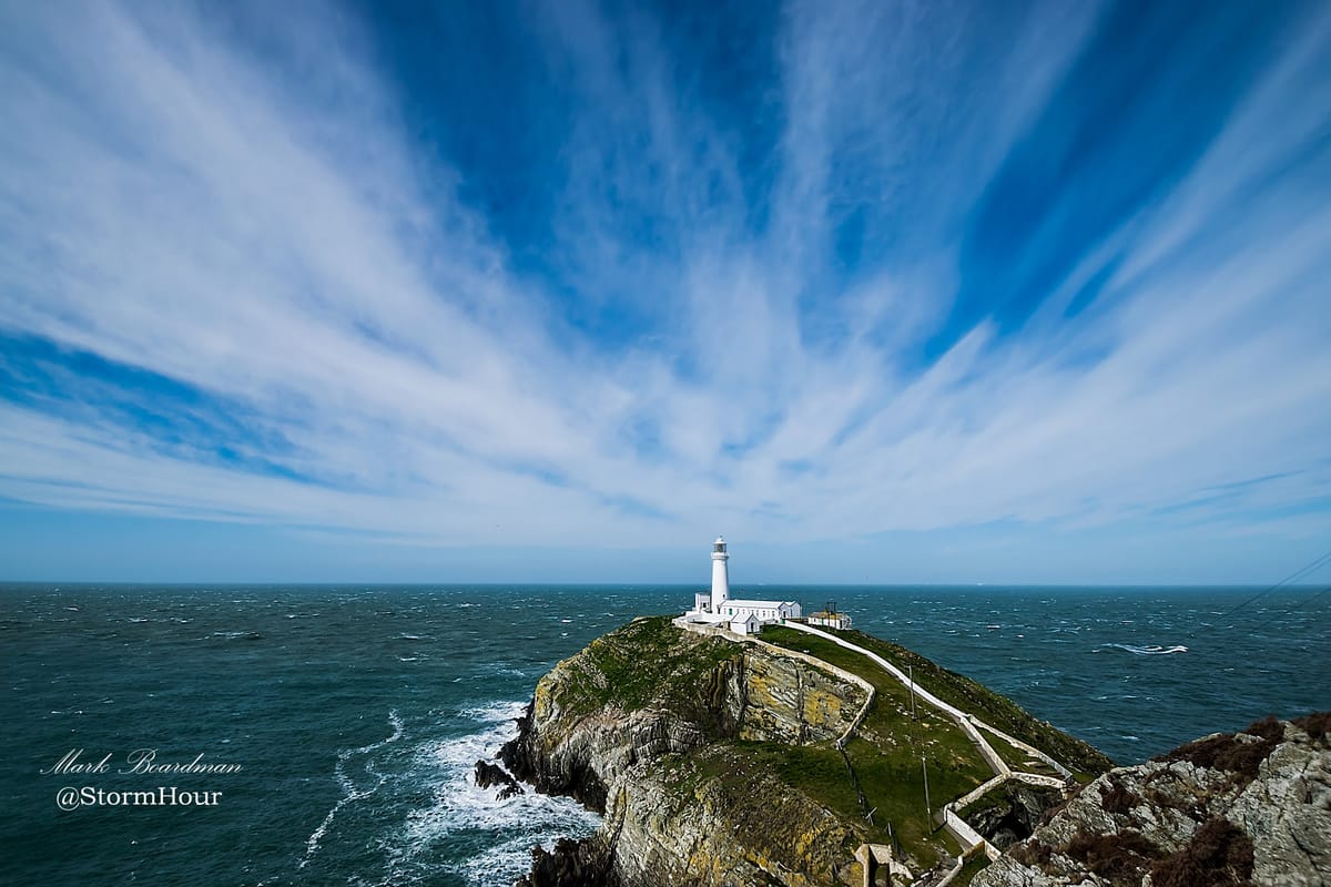
For photographers, cirrus offers texture rather than drama. It pairs well with wide skies, minimal foregrounds and moments of transition: sunrise, sunset, the hours when the sky is changing its mind. Because cirrus evolves slowly, it rewards those willing to wait and watch rather than chase.
What cirrus can tell us, and what it can’t
Cirrus clouds are often described as a sign of change, particularly when they thicken and increase ahead of a warm front. In many cases, that reputation is deserved. A growing veil of cirrus can be the first high-altitude signal of an approaching weather system, arriving a day or more before rain reaches the ground.
But cirrus does not always mean deterioration. Isolated streaks in an otherwise stable sky may persist for hours with little consequence. Cirrus formed from decaying thunderstorms can appear on days that remain dry and calm. Context matters: how the cirrus is changing, where it sits relative to other cloud layers, and what the broader pressure pattern is doing.
This uncertainty is part of why cirrus is so interesting to observers. It doesn’t offer simple answers. It invites interpretation. Watching cirrus develop over time, thinning, thickening and aligning with the upper winds, gives more information than a single glance ever could.
Clouds that masquerade as cirrus
High clouds are easy to confuse, especially when you’re new to watching them. Cirrostratus can look similar at first, but it tends to form broader, milkier sheets that blur the sky rather than trace it. If the sun or moon looks as though it’s shining through frosted glass, cirrostratus is likely involved.
Cirrocumulus sits at a similar altitude but breaks into small, grainy patches or ripples. It has texture without threads. Cirrus, by contrast, always feels pulled and drawn out, shaped by motion rather than instability.
Closer to the ground, thin altostratus or even high altocumulus can occasionally be mistaken for cirrus, especially in hazy conditions. The key difference is scale and sharpness. Cirrus looks etched. Lower clouds, even thin ones, tend to have softer edges and more depth.
Why cirrus matters
For forecasters, cirrus provides clues about upper-level flow and moisture that aren’t visible in surface observations. For pilots, it marks the presence of ice at cruising altitude and hints at jet stream location. For photographers and sky watchers, it’s often the first sign that the atmosphere is doing something quietly interesting.
Cirrus clouds remind us that weather is three-dimensional. What happens far above us matters, even if we never feel it directly. They also slow us down. You can’t read cirrus in a hurry. You have to notice how it changes, how it aligns, how it fades.
There’s a particular pleasure in recognising cirrus for what it is, especially on days when nothing else seems to be happening. It sharpens attention. It encourages looking up not for spectacle, but for understanding.
The next time you see those pale strokes high overhead, resist the urge to label them and move on. Watch how they shift against the blue. Notice how the light bends around them. Cirrus clouds are the handwriting of the upper atmosphere, faint, elegant and easy to miss unless you’re paying attention.
Cirrus clouds don’t ask much of the observer. They don’t insist on interpretation, and they rarely demand a response. Often, they are simply there, thinning, stretching and dissolving, while everything closer to the ground carries on as usual.
Spending time with them changes how the sky feels. You begin to notice height as well as movement, light as well as cloud. The atmosphere stops being a ceiling and starts to feel layered, active and alive above your head.
Cirrus reminds us that not all weather announces itself. Some of it passes quietly, written in ice and light, only visible to those who look up long enough to notice it fading.
Turn AI Into Your Weather Photography Assistant
Want to go deeper?
Download 25 AI Prompts That Will Transform Your Weather Photography and start using AI to:
• understand cloud formations
• analyse your storm photos
• plan better photography opportunities
• write more engaging captions
It only takes a couple of minutes to try—and the results might surprise you.