What Are Altocumulus Clouds? A Complete Guide for Weather Watchers and Photographers
Altocumulus clouds are one of the most visually striking cloud types. Learn how they form, what they mean for the weather, and how to photograph them.
Altocumulus Clouds Explained
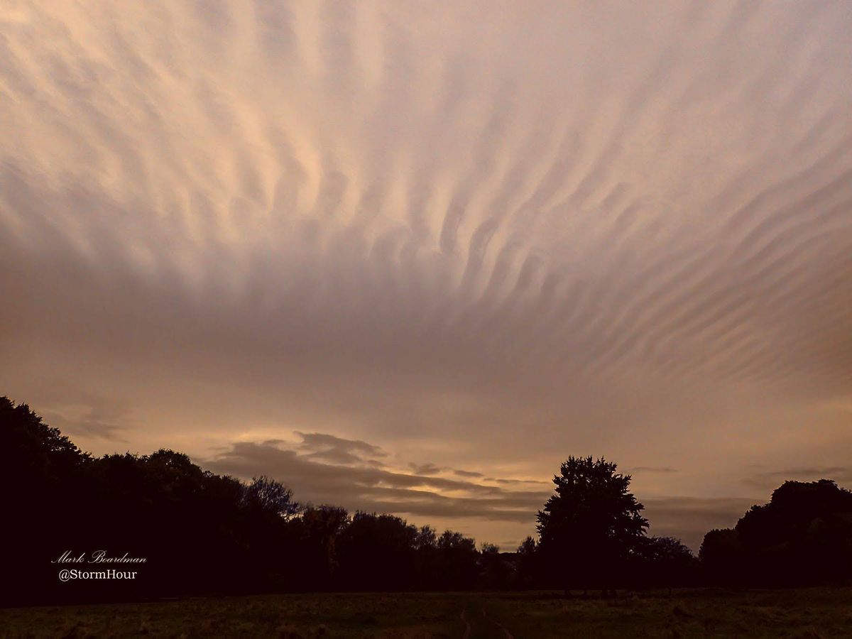
Altocumulus clouds are mid-level clouds made up of rounded patches, ripples, or layers, often appearing as a textured or “mackerel sky.” They typically form between 2,000 and 6,000 metres and can signal changing weather conditions.
Quick Facts
| Feature | Details |
|---|---|
| Cloud Type | Altocumulus |
| Altitude | 2,000–6,000 metres |
| Appearance | White/grey patches, ripples, or layers |
| Formation | Rising moist air cooling in mid-level atmosphere |
| Weather Signal | Often indicates instability or approaching change |
What Do Altocumulus Clouds Look Like?
When you look up and see rows of small, rounded cloud patches stretching across the sky, you’re likely seeing altocumulus clouds.
They often appear:
- In bands or waves
- With light and shadow giving a textured look
- Like fish scales — hence the term mackerel sky
Unlike higher cirrocumulus clouds, altocumulus clouds tend to have more shading and appear slightly larger.
How Do Altocumulus Clouds Form?
Altocumulus clouds form when:
- Moist air rises into the mid-level atmosphere
- The air cools and condenses into water droplets
- Instability or wave motion shapes the cloud into patches or layers
This process often happens ahead of weather systems, especially when warm and cool air masses interact.
What Do Altocumulus Clouds Mean for the Weather?
Altocumulus clouds can be a sign of:
- Increasing atmospheric instability
- Moisture building at mid-levels
- A potential change in weather within the next 12–36 hours
In warmer months, they can sometimes precede thunderstorms later in the day.
However, they don’t always mean bad weather — sometimes they simply pass without major changes.
How to Photograph Altocumulus Clouds
Altocumulus clouds are a favourite among photographers because of their texture and depth.
Best conditions:
- Early morning or late afternoon (low sun enhances texture)
- Wide open skies
Camera settings:
- Aperture: f/8 – f/11
- ISO: 100–200
- Shutter speed: Adjust for light
Composition tips:
- Use foreground interest (trees, buildings, landscapes)
- Capture repeating patterns across the frame
- Try wide-angle lenses for dramatic effect
When and Where Can You See Altocumulus Clouds?
You’re most likely to see altocumulus clouds:
- During settled but slightly unstable conditions
- Ahead of weather fronts
- In temperate regions around the world
They can appear at any time of year but are especially common in spring and summer.
Altocumulus vs Cirrocumulus: What’s the Difference?
Altocumulus clouds are often confused with cirrocumulus clouds.
- Altocumulus: Larger, with shading, mid-level
- Cirrocumulus: Smaller, whiter, higher altitude, less shadow
A simple rule: if you see shadows within the cloud, it’s likely altocumulus.
FAQs
What causes altocumulus clouds?
They are caused by rising moist air cooling in the mid-atmosphere, often shaped by instability or air movement.
Do altocumulus clouds mean rain?
Not always, but they can indicate a change in weather or increasing instability.
Are altocumulus clouds rare?
No, they are quite common and can be seen in many parts of the world.
In Summary
Altocumulus clouds are mid-level, textured clouds that often signal changing atmospheric conditions and offer excellent opportunities for photography.
Keep exploring the sky
If you’ve enjoyed this, you might also like:
→ [Cirrus Clouds: A Photographer’s Guide]
📩 Join StormHour (Free)
Get more from your weather photography.
Join StormHour for free and get instant access to:
- Photography prompts
- Camera settings cheat sheets
- Member-only downloads
- Future guides and resources
Already a member? Check your dashboard for the latest downloads.
Your turn
Have you seen this cloud type recently—or tried photographing it?
Leave a comment below or share your experience. Every observation helps build a better understanding of the sky.